The Channel to the Sea
Draught of Hanseatic vessels. Of modern liners. Bulk goods in commerce. Importance of deep channel for steamers. Advantages of inland seaports. Types of modern steamers. Hamburg’s aim. Nature of channel improvement. The present channel. Future work. Cost of channel. Mediaeval tolls. Present channel dues. Principles of financial policy. Hamburg’s advantage over its rivals. Summary.
Chapter II. The Channel to the Sea.
The development of Hamburg’s hinterland has been sketched in the previous chapter. In the industrial development of Germany there was created the need for seaports to handle its increasingly large commerce with oversea. We have now to investigate the manner in which Hamburg, favored by an exceptional location, took advantage of its opportunity and became the greatest of European seaports. Next to the provision of modern harbor and terminal facilities, its most pressing need was the creation of a channel to the sea, adapted to the conditions of today.
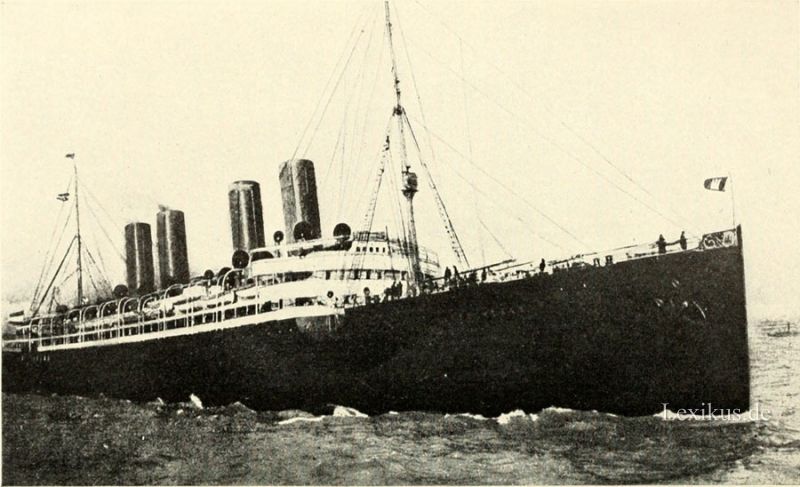
Of increasing importance to modern harbors are their channels to the sea. North European seaports were originally set at the point where river and ocean navigation met: the ocean-going vessels proceeded as far inland as they could. How far inland they could penetrate is indicated by the fact that one of the great Hanseatic seaports was Cologne on the Rhine, 210 miles up the river from the Hook of Holland.*) The channel from the sea to Cologne is today only nine feet, after the expenditure of millions of marks. In mediaeval times it could not have been six feet. Yet a channel of less than six feet sufficed to make Cologne a seaport like Hamburg and Lübeck and Bremen, It was to be accessible to seaships of such draught that Hamburg was located where it lies, eighty-five miles up the Elbe, Bremen seventy-five miles up the Weser, Antwerp fifty-nine miles up the Scheldt. The enormous expenditures necessary to adapt these channels to modern requirements are apparent when we consider into what the seaship of six feet draught has developed. The „Kaiserin Auguste Victoria,“ the largest steamer entering Hamburg, draws nearly thirty-three feet fully loaded, the „Mauretania“ and „Lusitania“ thirty-seven feet. The Cunard, White Star and HamburgAmerican Lines are each building liners which, each of 45,000 to 50,000 register tons,**) are to dwarf all previous creations.
*) Columbus’ three ships had the following dimensions: „Santa Maria,“ 300 register tons; „Pinta,“ 100 register tons; „Nina,“ 30 register tons. Their carrying capacity was approximately double their register tonnage. The „Santa Maria“ was about as capacious as a small Elbe river barge. The „Pinta“ was the size of a large harbor lighter, the „Nina“ the size of a small one.
**) The British register ton is an arbitrary unit of measurement for merchant ships; it represents 100 cubic feet of space. A ship’s total space available for sheltering merchandise, persons or machinery is expressed in register tons, gross. Its net register tonnage is this total minus the space occupied by machinery, officer and crew quarters, instrument rooms, etc. The net register tonnage of the ship represents its capacity for carrying passengers and goods, including coal and stores. The relationship of gross to net tonnage is in general 5:3 and in a freighter a net register ton means, on the average, capacity for 1 3/4 to 2 tons of freight.
Most of this increase in the tonnage and draught of vessels, and therefore in the depth of channel necessary to accommodate them, has occurred in the past century. In 1847 the Hamburg-American Line began its career with a new sailing ship, the „Deutschland,“ the pride of Hamburg. She was of 717 register tons. The „Kaiserin Auguste Victoria“ today has a gross register tonnage of 25,000. Correspondingly, Hamburg was satisfied in the forties with a channel of six and one half feet at low, thirteen feet at high water. The normal sailing vessel of the forties was of 200 to 300 register tons, or about 450 tons carrying capacity. Barges of 1,000 tons capacity are now towed up the Elbe 500 miles, to Prague, in Bohemia.
Then came that remarkable change in ocean commerce wliich is characterized by the appearance, for the first time, of great quantities of bulk goods of low specific value. Improved means of transportation — the steamship on the sea and the railroad on land — made it possible to move these goods from land to land. The physical limitations to the size of wooden sailing ships did not affect iron and steel steamers. They can be built indefinitely large, and, provided there is a sufficiently large stream of traffic, they are profitable to operate directly in proportion to their size.*
The Elbe valley from the sea to a point above Hamburg was originally a bay of the North Sea. When Hamburg was founded, the valley had mudded up and was an uninhabitable bog, through which the river wandered, in many constantly shifting channels, to the sea. The principal work before the nineteenth century Avas, by the erection of dikes, to reduce the number of these arms. Until the middle of the nineteenth century, the lack of depth of the channel was not felt to be a disadvantage.
*) It was the Germans who first recognized the greater profitableness of the larger steamers. In 1901, although the British merchant marine was five and one half times larger than the German, England possessed only 28 steamers over 10,000 tons gross, while Germany had 24, America 6. (Report of the Royal Commission on the Port of London, 1902, page 26.) Today the Hamburg-American Line alone has 11 steamers of over 13,000 gross register tons each, America 3. (Hamburg als SchiflFahrtsund Industrieplatz, Mai, 1910; and Report of the U. S. Commissioner of Navigation, 1909.)
Besides reducing the number of arms of the river and attempting to give the main channel a fixed location, improvements included buoying off the channel and maintaining a lighthouse at its mouth. In 1246 the Archbishop of Bremen gave Hamburg half the island of Neuwerk, near the present site of Cuxhaven, on condition that a lighthouse should be maintained there. One of wooden construction, with stone foundation, was built, and an open fire was kept burning on an upper platform. It is the oldest lighthouse in the world still in use.
If steamers had not supplanted sailing ships it would probably have sufficed to create a channel up which the sailers could have come at high tides. Even the packet sailers operated on only a nominal schedule. They arrived on time „wind and weather permitting.“ The time they took up in the journey was so great that a delay of half a day waiting for high tide would not have seriously inconvenienced them. But steamship schedules are published a season in advance; incoming and outgoing liners connect with special trains. Some of the liners of today cost ten to twelve million marks. The profit from such vessels depends on the number of trips they can make in a year, and this number must not — if it can be avoided — be reduced by having to wait for high water to come up to the port. The ideal is for the channel to be so deep that all vessels using it can go up the river at low water. The next possibility is to have the channel so deep that at low water most of the ships can go up, while the very largest wait for higher stages of water. The third possibility is to give up hope of having the largest steamers reach the port and, in view of this, creating for them a sub-port nearer the mouth of the river.
This last course is a very serious matter. Ocean rates are no cheaper to the sub-port than to the main port higher up, while the railway rates inland, which go by mileage, are considerably higher for the more distant subport. Moreover, unless the costly warehouses of the mother port are to be duplicated downstream, all vessels discharging warehouse goods at the sub-port must send them by lighter or rail to the warehouses upstream. London has chosen this course. Tillbury docks are the sub-port; warehouse goods coming, for instance, by the Atlantic Transport Line or the Peninsular and Oriental are lightered (or railed) to the warehouses in London, Tillbury docks being about twenty-five miles below London Bridge. Bremen has had to pursue the same course and construct in Bremerhaven, near the mouth of the Weser, a duplicate of its harbor at Bremen, excepting for warehouses, in order to accommodate the North Atlantic liners of the North German Lloyd. The ideal of having a channel up which all ships could come at all times is not attained either by Hamburg or its competitors in northern Europe: Bremen, Amsterdam, Rotterdam, Antwerp, Havre, London and Liverpool. Our American North Atlantic ports are preeminent in that they are, or soon will be, accessible at low tide to all ships that care to enter them: New York with a channel of forty feet at low water, Boston with thirty feet (soon thirty-five), Philadelphia with thirty feet (soon thirty-five), Baltimore with thirty feet.
Liverpool, Antwerp, Rotterdam, Havre and Hamburg have had to be satisfied with a partial attainment of the ideal. In all of them, large ships can enter only at the higher stages of water. No beneficent national government has dug Hamburg’s channel for her; the little citystate has done her own dredging, as Bremen has.*) In Germany, river and harbor improvements fall to the states in whose territories they lie and are no concern of the Empire. The Elbe below Hamburg flows between the Prussian provinces of Hanover and Schleswig-Holstein. Under treaties, first with the kingdoms of Hanover and Denmark, later with Prussia,**) after she had annexed Hannover and Schleswig-Holstein, Hamburg has done all the work on the river.
In the forties Hamburg was possessed of a channel to the sea of six and one half feet at low water, thirteen feet at high.***) In order to see what Hamburg has had to strive after, it is well to consider the main types of ocean-going steamship that have developed for her. Tramp steamers are not usually of over twenty-one to twenty-four feet draught. The liners are divisible, as far as Hamburg is concerned, into three classes: the steamers in the European service, the steamers in the Suez service to the Far East, the liners in the transatlantic service. The European liners have a maximum draught of about nineteen and one half feet, determined by the depth of the numerous harborchannels they must enter. The draught of the Suez liners is determined by the regulations of the officials of the Suez Canal. Up to 1902 the permissible draught in this service was twenty-three feet (seven meters****); it was then raised
*) Yet J. Paul Goode states in his report to the Chicago Harbor Commission, referring to Hamburg: „The German Government takes care of the channel.“ (Report of the Commission, page 134.)
**) The relations between Hamburg and Prussia in this respect are regulated by the Kohlbrand Treaty.
***) Wiedenfeld: Die Welthäfen, page 53.
****) A meter is 3.28 feet, roughly 3 1/4 feet.
to twenty-six and one fourth feet. Liners of the transatlantic service to New York draw, fully loaded, up to 32.8 feet (the „Kaiserin Auguste Victoria“).*)
Hamburg has striven and still strives to keep a channel that will let the European liners come up to the harbor at all stages of water, the Suez liners excepting at low water; the transatlantic liners are to be able to get up at high water without lightering, which is a costly performance.**) For years the large liners from New York, in order to reach Hamburg even at high water, had to lighter a part of their cargo at Brunshausen, twenty miles below the harbor, at the lower end of a bar which has occasioned most of the dredging. Outbound ships had to complete their cargoes from lighters after they had passed the bar. It was the costliness of these operations that induced the Hamburg-American Line to consider despatching its New York liners from Cuxhaven, at the mouth of the river, eighty-five miles down stream. The unfortunate results of the first year’s occupancy of Cuxhaven and the prospect that the new regulation of the Elbe, begun in 1902, would make it possible for vessels of the greatest draught to reach Hamburg without lightering, caused Cuxhaven to be abandoned by the liners except as a port of call.
*) It must not be thought that vessels can load to utilize the full channel depth. When moving at any speed, a vessel „settles“ below her stationary loaded draught. Moreover, when the depth of channel is too completely utilized, the vessel „feels“ the bottom and answers her helm badly. One meter (3 1/4 feet) is a small margin to leave between keel and bed of the river; 31.16 feet is the maximum draught of a vessel entering the port of Hamburg. At present two steamers, the „Kaiserin Auguste Victoria“ and the „Amerika,“ are not ordinarily brought up above Brunshausen without lightering at that point. Here they also complete their cargoes, outbound. These two ships of this class, on arriving from New York, can sometimes reach the port with depleted coal bunkers, but cannot clear with full bunkers and full cargo. (Barge Canal Report, pages 396, 416.)
**) Rates for lighter service between Brunshausen and Hamburg are 1.80 marks per ton (42.84 cents) in summer; 2.50 marks (59.5 cents) per ton in winter, or more, if ice conditions are particularly unfavorable.
Fortunately, at the same time that steamships of rapidly increasing size demanded a deeper channel, the steam dredge was invented, which alone made a deeper channel possible. In addition to dredging, the channel has been deepened by the construction of fascine-work moles, which run out from either bank of the river, slanting down stream, their backs just below high water. The distance between the heads of opposite moles is the desired width of the channel. The river bed fills up between consecutive moles and the current, confined to the narrower channel, has sufficient force to scour it and prevent it from sanding up. An elaborate system of buoys on the water, landmarks and lights on the land, is maintained, so that ships can come up the river by night as well as by day. Ice breakers have kept the river open for navigation all winter, since 1876. In 1800 skating and racing on the lower Elbe were annual diversions of the Hamburgers; the Elbe froze so hard that vessels were „loaden and unloaden on the ice.“*)
*) The Picture of Hamburg. Navigation on the lower Elbe was closed, because of ice, for sixty-one days in 1847, eighty-one days in 1855, fifty-three days in 1871. (De Rousiers, page 209.)
In the summer of 1910 the Hamburg officials could boast that all large ships entering the Elbe had been able to come up to the harbor and that not a vessel had been compelled to lighter during the year. That is, accessibility, at high water and without hghtering, had been attained for the largest boats in the transatlantic service. But for one consideration accessibility for ships of the Suez service at all but the low stages of water would have been attained; twenty-six and one fourth feet was the low water depth of the channel. The reason why this was not accomplished is one that indicated how endless is the task of channel improvement. On January 1, 1910, the draught permissible to steamers using the Suez Canal had been raised to twenty-nine and one fourth feet (nine meters).
So at present Hamburg has a channel to the sea, eightyfive miles long, of 650 feet width (200 meters), twenty-six and one fourth feet depth at low water (eight meters), 32.8 feet at high water (ten meters). Two considerations make it certain that the work will proceed. One is that one meter more is needed to bring the deepest-going Suez boats up at all but low stages of water, and this is part of Hamburg’s policy. The other reason is: the HamburgAmerican Line is building in the „Imperator,“ 50,000 tons gross, a liner twice as large as the present largest ship entering the Elbe, the „Kaiserin Auguste Victoria,“ 25,000 tons gross. At present the „Imperator“ could not get up to Hamburg at all. It is improbable that this new colossus is being constructed without an understanding with the Hamburg state that there will be a channel ready for her when she is finished.*)
*) As this goes to press, State Engineer Bubendey writes from Hamburg: „We are now working on a further deepening of the Elbe from Hamburg to the sea. A low water channel depth of nine meters is being created; it will be ten meters later. These will correspond to high water depths of eleven and twelve meters, respectively.“
Today the most important element in the competition of the ports of northwestern Europe is their relative distances from the common hinterland. Hamburg has been, and still is, ready to spend large sums to bring her ships eighty-five miles further inland. Expenditures on the channel from 1850 to 1906 totaled sixty-two million marks.*)
Up to 1861 there was a toll on all ships using the Elbe, collected by the government of Hanover at Stade, between Hamburg and the sea. In 1861 this toll was bought off, through the payment to Hanover, by a number of maritime nations, of a sum approximating $750,000. In a similar manner the Sund toll, levied by Denmark on ships entering the Baltic, had been bought off a few years before; in 1862 the Dutch were similarly compensated for removing the toll on navigation passing up the Scheldt to Antwerp, the commercial rival of their seaports. These were three remains of a vast and burdensome system of traffic tolls which stood in no relation to services rendered in aid of navigation.
Hamburg collected no formal due to repay her for her expenditures on the channel until the last expensive dredging in the years 1902-05. Since then she has collected a tonnage due on all seaships above a small minimum tonnage. It goes under the name of „buoy due“ (Tonnengeld) and „declaration due“ (Deklarationsgeld), and appeared at 3,305,000 marks in the estimate for 1906.**) Vessels arriving from sea pay 12 pfennigs per cubic meter net: 8.1 cents per net register ton.***) Vessels with cargoes of coal, cement and various other bulk goods, pay half the regular tonnage due, as do vessels arriving in ballast and departing with cargo. Ships that come and leave in ballast are exempt from tonnage dues; likewise ships built in Hamburg and returning from their maiden trips.****) Small steamers and lighters coming direct from points on the German Rhine, as well as lighters that come from points on the Dortmund-Ems Canal, are also exempt. The purpose of this is to offer every inducement to the commerce of rich western Germany, which naturally gravitates to the nearer ports of Rotterdam and Antwerp.
*) Peters, part II., page 277.
**) Richter, page 29.
***) A register ton is 2.83 cubic meters.
****) *) Barge Canal Report, Vol. I., page 397.
It is doubtful whether the annual three and one third million marks of channel dues represent anything more than a nominal return, after maintenance is paid for, on the sixty-two million marks that have been spent on the channel since 1850. It is Hamburg’s advantage that it is a state as well as a city, that it has no limit of bonded indebtedness imposed by a superior power, that it is not obliged to make any specific return on money invested in the harbor and channel. Hamburg proceeds on the principle that a tax on traffic is bad. The mere fact that a shipment is made via Hamburg is no evidence that its owner is able to pay a tax sufficiently high to make a full return for all facilities afforded him. When the unhindered flow of commerce has crystallized into wealth in the hands of merchants, forwarders, warehousers and shipowners, it is time to tax this wealth, primarily through a property and an income tax.
Stettin, Hamburg’s rival on the Baltic, who dreams of becoming the third great German seaport and who is Hamburg’s competitor for the foreign trade of Berlin and Silesia, is a Prussian seaport and has had its channel dug by the Prussian government, down the river Oder and through a shallow bay (Haff) to the sea. On April 27, 1909, a Stettin representative in the Prussian Diet arose to complain that the government’s treatment of Stettin had made it impossible for that port to compete with Hamburg. „To be sure, the government has dredged a channel for us from Swinemünde to Stettin, but it has introduced a very unpopular channel due, levied on every ship coming up the Oder. A ship that has 270 marks in dues of this nature to pay in Hamburg, pays 1,102.50 marks in Stettin. In Hamburg they pay six pfennigs per cubic meter tonnage, in Stettin we pay twenty-eight pfennigs. Under such conditions Stettin can hardly hope to meet successfully the tremendous competition of Hamburg.“
Von Breitenbach, the Prussian Minister of Public Works, was present and answered the complaint with arguments that show the advantages that Hamburg possesses in being a state. He said, in part: „The Prussian state carries a heavy burden because of this channel. After paying maintenance, the dues represent 1.17 per cent on the capital invested, and no more; 644,000 marks per year are lacking to constitute a proper return on the money we have spent. We have done all we can for Stettin. It is not allowable to compare Stettin with Hamburg and Lübeck. The latter are purely commercial states, which can devote their entire interest to fostering their commerce. The Prussian state has far wider interests and obligations. We cannot exert our entire influence in behalf of a single commercial port.“
Hamburg, lying far up the Elbe, has seen itself compelled to spend large sums to allow the leviathan steamers of today to reach the port. It was willing to spend these sums rather than to consent to the creation of a sub-port for the larger ships, because it realized that all freight discharged at the sub-port would have heavier railway charges to bear. Not only are all vessels using the port able to reach it today; but provision is also being made for a channel that will suffice even the „Imperator“ when she is finished. Hamburg, being an independent state, has had to dig the channel herself, but is free from the necessity of charging for its use dues that discourage traffic — an advantage that Hamburg enjoys over all its German rivals excepting Bremen.
Chapter II. The Channel to the Sea.
The development of Hamburg’s hinterland has been sketched in the previous chapter. In the industrial development of Germany there was created the need for seaports to handle its increasingly large commerce with oversea. We have now to investigate the manner in which Hamburg, favored by an exceptional location, took advantage of its opportunity and became the greatest of European seaports. Next to the provision of modern harbor and terminal facilities, its most pressing need was the creation of a channel to the sea, adapted to the conditions of today.
Of increasing importance to modern harbors are their channels to the sea. North European seaports were originally set at the point where river and ocean navigation met: the ocean-going vessels proceeded as far inland as they could. How far inland they could penetrate is indicated by the fact that one of the great Hanseatic seaports was Cologne on the Rhine, 210 miles up the river from the Hook of Holland.*) The channel from the sea to Cologne is today only nine feet, after the expenditure of millions of marks. In mediaeval times it could not have been six feet. Yet a channel of less than six feet sufficed to make Cologne a seaport like Hamburg and Lübeck and Bremen, It was to be accessible to seaships of such draught that Hamburg was located where it lies, eighty-five miles up the Elbe, Bremen seventy-five miles up the Weser, Antwerp fifty-nine miles up the Scheldt. The enormous expenditures necessary to adapt these channels to modern requirements are apparent when we consider into what the seaship of six feet draught has developed. The „Kaiserin Auguste Victoria,“ the largest steamer entering Hamburg, draws nearly thirty-three feet fully loaded, the „Mauretania“ and „Lusitania“ thirty-seven feet. The Cunard, White Star and HamburgAmerican Lines are each building liners which, each of 45,000 to 50,000 register tons,**) are to dwarf all previous creations.
*) Columbus’ three ships had the following dimensions: „Santa Maria,“ 300 register tons; „Pinta,“ 100 register tons; „Nina,“ 30 register tons. Their carrying capacity was approximately double their register tonnage. The „Santa Maria“ was about as capacious as a small Elbe river barge. The „Pinta“ was the size of a large harbor lighter, the „Nina“ the size of a small one.
**) The British register ton is an arbitrary unit of measurement for merchant ships; it represents 100 cubic feet of space. A ship’s total space available for sheltering merchandise, persons or machinery is expressed in register tons, gross. Its net register tonnage is this total minus the space occupied by machinery, officer and crew quarters, instrument rooms, etc. The net register tonnage of the ship represents its capacity for carrying passengers and goods, including coal and stores. The relationship of gross to net tonnage is in general 5:3 and in a freighter a net register ton means, on the average, capacity for 1 3/4 to 2 tons of freight.
Most of this increase in the tonnage and draught of vessels, and therefore in the depth of channel necessary to accommodate them, has occurred in the past century. In 1847 the Hamburg-American Line began its career with a new sailing ship, the „Deutschland,“ the pride of Hamburg. She was of 717 register tons. The „Kaiserin Auguste Victoria“ today has a gross register tonnage of 25,000. Correspondingly, Hamburg was satisfied in the forties with a channel of six and one half feet at low, thirteen feet at high water. The normal sailing vessel of the forties was of 200 to 300 register tons, or about 450 tons carrying capacity. Barges of 1,000 tons capacity are now towed up the Elbe 500 miles, to Prague, in Bohemia.
Then came that remarkable change in ocean commerce wliich is characterized by the appearance, for the first time, of great quantities of bulk goods of low specific value. Improved means of transportation — the steamship on the sea and the railroad on land — made it possible to move these goods from land to land. The physical limitations to the size of wooden sailing ships did not affect iron and steel steamers. They can be built indefinitely large, and, provided there is a sufficiently large stream of traffic, they are profitable to operate directly in proportion to their size.*
The Elbe valley from the sea to a point above Hamburg was originally a bay of the North Sea. When Hamburg was founded, the valley had mudded up and was an uninhabitable bog, through which the river wandered, in many constantly shifting channels, to the sea. The principal work before the nineteenth century Avas, by the erection of dikes, to reduce the number of these arms. Until the middle of the nineteenth century, the lack of depth of the channel was not felt to be a disadvantage.
*) It was the Germans who first recognized the greater profitableness of the larger steamers. In 1901, although the British merchant marine was five and one half times larger than the German, England possessed only 28 steamers over 10,000 tons gross, while Germany had 24, America 6. (Report of the Royal Commission on the Port of London, 1902, page 26.) Today the Hamburg-American Line alone has 11 steamers of over 13,000 gross register tons each, America 3. (Hamburg als SchiflFahrtsund Industrieplatz, Mai, 1910; and Report of the U. S. Commissioner of Navigation, 1909.)
Besides reducing the number of arms of the river and attempting to give the main channel a fixed location, improvements included buoying off the channel and maintaining a lighthouse at its mouth. In 1246 the Archbishop of Bremen gave Hamburg half the island of Neuwerk, near the present site of Cuxhaven, on condition that a lighthouse should be maintained there. One of wooden construction, with stone foundation, was built, and an open fire was kept burning on an upper platform. It is the oldest lighthouse in the world still in use.
If steamers had not supplanted sailing ships it would probably have sufficed to create a channel up which the sailers could have come at high tides. Even the packet sailers operated on only a nominal schedule. They arrived on time „wind and weather permitting.“ The time they took up in the journey was so great that a delay of half a day waiting for high tide would not have seriously inconvenienced them. But steamship schedules are published a season in advance; incoming and outgoing liners connect with special trains. Some of the liners of today cost ten to twelve million marks. The profit from such vessels depends on the number of trips they can make in a year, and this number must not — if it can be avoided — be reduced by having to wait for high water to come up to the port. The ideal is for the channel to be so deep that all vessels using it can go up the river at low water. The next possibility is to have the channel so deep that at low water most of the ships can go up, while the very largest wait for higher stages of water. The third possibility is to give up hope of having the largest steamers reach the port and, in view of this, creating for them a sub-port nearer the mouth of the river.
This last course is a very serious matter. Ocean rates are no cheaper to the sub-port than to the main port higher up, while the railway rates inland, which go by mileage, are considerably higher for the more distant subport. Moreover, unless the costly warehouses of the mother port are to be duplicated downstream, all vessels discharging warehouse goods at the sub-port must send them by lighter or rail to the warehouses upstream. London has chosen this course. Tillbury docks are the sub-port; warehouse goods coming, for instance, by the Atlantic Transport Line or the Peninsular and Oriental are lightered (or railed) to the warehouses in London, Tillbury docks being about twenty-five miles below London Bridge. Bremen has had to pursue the same course and construct in Bremerhaven, near the mouth of the Weser, a duplicate of its harbor at Bremen, excepting for warehouses, in order to accommodate the North Atlantic liners of the North German Lloyd. The ideal of having a channel up which all ships could come at all times is not attained either by Hamburg or its competitors in northern Europe: Bremen, Amsterdam, Rotterdam, Antwerp, Havre, London and Liverpool. Our American North Atlantic ports are preeminent in that they are, or soon will be, accessible at low tide to all ships that care to enter them: New York with a channel of forty feet at low water, Boston with thirty feet (soon thirty-five), Philadelphia with thirty feet (soon thirty-five), Baltimore with thirty feet.
Liverpool, Antwerp, Rotterdam, Havre and Hamburg have had to be satisfied with a partial attainment of the ideal. In all of them, large ships can enter only at the higher stages of water. No beneficent national government has dug Hamburg’s channel for her; the little citystate has done her own dredging, as Bremen has.*) In Germany, river and harbor improvements fall to the states in whose territories they lie and are no concern of the Empire. The Elbe below Hamburg flows between the Prussian provinces of Hanover and Schleswig-Holstein. Under treaties, first with the kingdoms of Hanover and Denmark, later with Prussia,**) after she had annexed Hannover and Schleswig-Holstein, Hamburg has done all the work on the river.
In the forties Hamburg was possessed of a channel to the sea of six and one half feet at low water, thirteen feet at high.***) In order to see what Hamburg has had to strive after, it is well to consider the main types of ocean-going steamship that have developed for her. Tramp steamers are not usually of over twenty-one to twenty-four feet draught. The liners are divisible, as far as Hamburg is concerned, into three classes: the steamers in the European service, the steamers in the Suez service to the Far East, the liners in the transatlantic service. The European liners have a maximum draught of about nineteen and one half feet, determined by the depth of the numerous harborchannels they must enter. The draught of the Suez liners is determined by the regulations of the officials of the Suez Canal. Up to 1902 the permissible draught in this service was twenty-three feet (seven meters****); it was then raised
*) Yet J. Paul Goode states in his report to the Chicago Harbor Commission, referring to Hamburg: „The German Government takes care of the channel.“ (Report of the Commission, page 134.)
**) The relations between Hamburg and Prussia in this respect are regulated by the Kohlbrand Treaty.
***) Wiedenfeld: Die Welthäfen, page 53.
****) A meter is 3.28 feet, roughly 3 1/4 feet.
to twenty-six and one fourth feet. Liners of the transatlantic service to New York draw, fully loaded, up to 32.8 feet (the „Kaiserin Auguste Victoria“).*)
Hamburg has striven and still strives to keep a channel that will let the European liners come up to the harbor at all stages of water, the Suez liners excepting at low water; the transatlantic liners are to be able to get up at high water without lightering, which is a costly performance.**) For years the large liners from New York, in order to reach Hamburg even at high water, had to lighter a part of their cargo at Brunshausen, twenty miles below the harbor, at the lower end of a bar which has occasioned most of the dredging. Outbound ships had to complete their cargoes from lighters after they had passed the bar. It was the costliness of these operations that induced the Hamburg-American Line to consider despatching its New York liners from Cuxhaven, at the mouth of the river, eighty-five miles down stream. The unfortunate results of the first year’s occupancy of Cuxhaven and the prospect that the new regulation of the Elbe, begun in 1902, would make it possible for vessels of the greatest draught to reach Hamburg without lightering, caused Cuxhaven to be abandoned by the liners except as a port of call.
*) It must not be thought that vessels can load to utilize the full channel depth. When moving at any speed, a vessel „settles“ below her stationary loaded draught. Moreover, when the depth of channel is too completely utilized, the vessel „feels“ the bottom and answers her helm badly. One meter (3 1/4 feet) is a small margin to leave between keel and bed of the river; 31.16 feet is the maximum draught of a vessel entering the port of Hamburg. At present two steamers, the „Kaiserin Auguste Victoria“ and the „Amerika,“ are not ordinarily brought up above Brunshausen without lightering at that point. Here they also complete their cargoes, outbound. These two ships of this class, on arriving from New York, can sometimes reach the port with depleted coal bunkers, but cannot clear with full bunkers and full cargo. (Barge Canal Report, pages 396, 416.)
**) Rates for lighter service between Brunshausen and Hamburg are 1.80 marks per ton (42.84 cents) in summer; 2.50 marks (59.5 cents) per ton in winter, or more, if ice conditions are particularly unfavorable.
Fortunately, at the same time that steamships of rapidly increasing size demanded a deeper channel, the steam dredge was invented, which alone made a deeper channel possible. In addition to dredging, the channel has been deepened by the construction of fascine-work moles, which run out from either bank of the river, slanting down stream, their backs just below high water. The distance between the heads of opposite moles is the desired width of the channel. The river bed fills up between consecutive moles and the current, confined to the narrower channel, has sufficient force to scour it and prevent it from sanding up. An elaborate system of buoys on the water, landmarks and lights on the land, is maintained, so that ships can come up the river by night as well as by day. Ice breakers have kept the river open for navigation all winter, since 1876. In 1800 skating and racing on the lower Elbe were annual diversions of the Hamburgers; the Elbe froze so hard that vessels were „loaden and unloaden on the ice.“*)
*) The Picture of Hamburg. Navigation on the lower Elbe was closed, because of ice, for sixty-one days in 1847, eighty-one days in 1855, fifty-three days in 1871. (De Rousiers, page 209.)
In the summer of 1910 the Hamburg officials could boast that all large ships entering the Elbe had been able to come up to the harbor and that not a vessel had been compelled to lighter during the year. That is, accessibility, at high water and without hghtering, had been attained for the largest boats in the transatlantic service. But for one consideration accessibility for ships of the Suez service at all but the low stages of water would have been attained; twenty-six and one fourth feet was the low water depth of the channel. The reason why this was not accomplished is one that indicated how endless is the task of channel improvement. On January 1, 1910, the draught permissible to steamers using the Suez Canal had been raised to twenty-nine and one fourth feet (nine meters).
So at present Hamburg has a channel to the sea, eightyfive miles long, of 650 feet width (200 meters), twenty-six and one fourth feet depth at low water (eight meters), 32.8 feet at high water (ten meters). Two considerations make it certain that the work will proceed. One is that one meter more is needed to bring the deepest-going Suez boats up at all but low stages of water, and this is part of Hamburg’s policy. The other reason is: the HamburgAmerican Line is building in the „Imperator,“ 50,000 tons gross, a liner twice as large as the present largest ship entering the Elbe, the „Kaiserin Auguste Victoria,“ 25,000 tons gross. At present the „Imperator“ could not get up to Hamburg at all. It is improbable that this new colossus is being constructed without an understanding with the Hamburg state that there will be a channel ready for her when she is finished.*)
*) As this goes to press, State Engineer Bubendey writes from Hamburg: „We are now working on a further deepening of the Elbe from Hamburg to the sea. A low water channel depth of nine meters is being created; it will be ten meters later. These will correspond to high water depths of eleven and twelve meters, respectively.“
Today the most important element in the competition of the ports of northwestern Europe is their relative distances from the common hinterland. Hamburg has been, and still is, ready to spend large sums to bring her ships eighty-five miles further inland. Expenditures on the channel from 1850 to 1906 totaled sixty-two million marks.*)
Up to 1861 there was a toll on all ships using the Elbe, collected by the government of Hanover at Stade, between Hamburg and the sea. In 1861 this toll was bought off, through the payment to Hanover, by a number of maritime nations, of a sum approximating $750,000. In a similar manner the Sund toll, levied by Denmark on ships entering the Baltic, had been bought off a few years before; in 1862 the Dutch were similarly compensated for removing the toll on navigation passing up the Scheldt to Antwerp, the commercial rival of their seaports. These were three remains of a vast and burdensome system of traffic tolls which stood in no relation to services rendered in aid of navigation.
Hamburg collected no formal due to repay her for her expenditures on the channel until the last expensive dredging in the years 1902-05. Since then she has collected a tonnage due on all seaships above a small minimum tonnage. It goes under the name of „buoy due“ (Tonnengeld) and „declaration due“ (Deklarationsgeld), and appeared at 3,305,000 marks in the estimate for 1906.**) Vessels arriving from sea pay 12 pfennigs per cubic meter net: 8.1 cents per net register ton.***) Vessels with cargoes of coal, cement and various other bulk goods, pay half the regular tonnage due, as do vessels arriving in ballast and departing with cargo. Ships that come and leave in ballast are exempt from tonnage dues; likewise ships built in Hamburg and returning from their maiden trips.****) Small steamers and lighters coming direct from points on the German Rhine, as well as lighters that come from points on the Dortmund-Ems Canal, are also exempt. The purpose of this is to offer every inducement to the commerce of rich western Germany, which naturally gravitates to the nearer ports of Rotterdam and Antwerp.
*) Peters, part II., page 277.
**) Richter, page 29.
***) A register ton is 2.83 cubic meters.
****) *) Barge Canal Report, Vol. I., page 397.
It is doubtful whether the annual three and one third million marks of channel dues represent anything more than a nominal return, after maintenance is paid for, on the sixty-two million marks that have been spent on the channel since 1850. It is Hamburg’s advantage that it is a state as well as a city, that it has no limit of bonded indebtedness imposed by a superior power, that it is not obliged to make any specific return on money invested in the harbor and channel. Hamburg proceeds on the principle that a tax on traffic is bad. The mere fact that a shipment is made via Hamburg is no evidence that its owner is able to pay a tax sufficiently high to make a full return for all facilities afforded him. When the unhindered flow of commerce has crystallized into wealth in the hands of merchants, forwarders, warehousers and shipowners, it is time to tax this wealth, primarily through a property and an income tax.
Stettin, Hamburg’s rival on the Baltic, who dreams of becoming the third great German seaport and who is Hamburg’s competitor for the foreign trade of Berlin and Silesia, is a Prussian seaport and has had its channel dug by the Prussian government, down the river Oder and through a shallow bay (Haff) to the sea. On April 27, 1909, a Stettin representative in the Prussian Diet arose to complain that the government’s treatment of Stettin had made it impossible for that port to compete with Hamburg. „To be sure, the government has dredged a channel for us from Swinemünde to Stettin, but it has introduced a very unpopular channel due, levied on every ship coming up the Oder. A ship that has 270 marks in dues of this nature to pay in Hamburg, pays 1,102.50 marks in Stettin. In Hamburg they pay six pfennigs per cubic meter tonnage, in Stettin we pay twenty-eight pfennigs. Under such conditions Stettin can hardly hope to meet successfully the tremendous competition of Hamburg.“
Von Breitenbach, the Prussian Minister of Public Works, was present and answered the complaint with arguments that show the advantages that Hamburg possesses in being a state. He said, in part: „The Prussian state carries a heavy burden because of this channel. After paying maintenance, the dues represent 1.17 per cent on the capital invested, and no more; 644,000 marks per year are lacking to constitute a proper return on the money we have spent. We have done all we can for Stettin. It is not allowable to compare Stettin with Hamburg and Lübeck. The latter are purely commercial states, which can devote their entire interest to fostering their commerce. The Prussian state has far wider interests and obligations. We cannot exert our entire influence in behalf of a single commercial port.“
Hamburg, lying far up the Elbe, has seen itself compelled to spend large sums to allow the leviathan steamers of today to reach the port. It was willing to spend these sums rather than to consent to the creation of a sub-port for the larger ships, because it realized that all freight discharged at the sub-port would have heavier railway charges to bear. Not only are all vessels using the port able to reach it today; but provision is also being made for a channel that will suffice even the „Imperator“ when she is finished. Hamburg, being an independent state, has had to dig the channel herself, but is free from the necessity of charging for its use dues that discourage traffic — an advantage that Hamburg enjoys over all its German rivals excepting Bremen.
Dieses Kapitel ist Teil des Buches The Port of Hamburg.
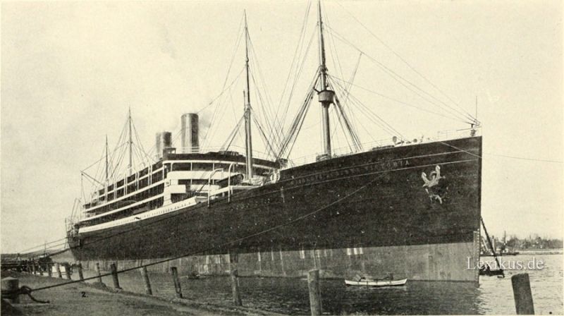
05. The „Kaiserin Auguste Victoria“.
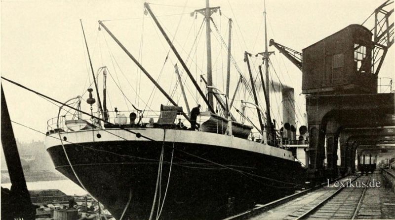
06. Hamburg freighter at a pier, discharging.
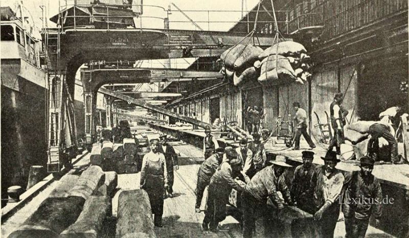
07. Pier cranes discharging cargo at Hamburg.
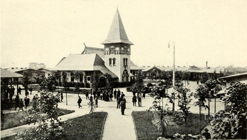
08. Church in the emigrant village at Hamburg.
09. The „Deutschland“
alle Kapitel sehen